Home » Map galleries » Airport landscapes » Southampton airport
Zoom-in on map (click/pinch) for more detail.
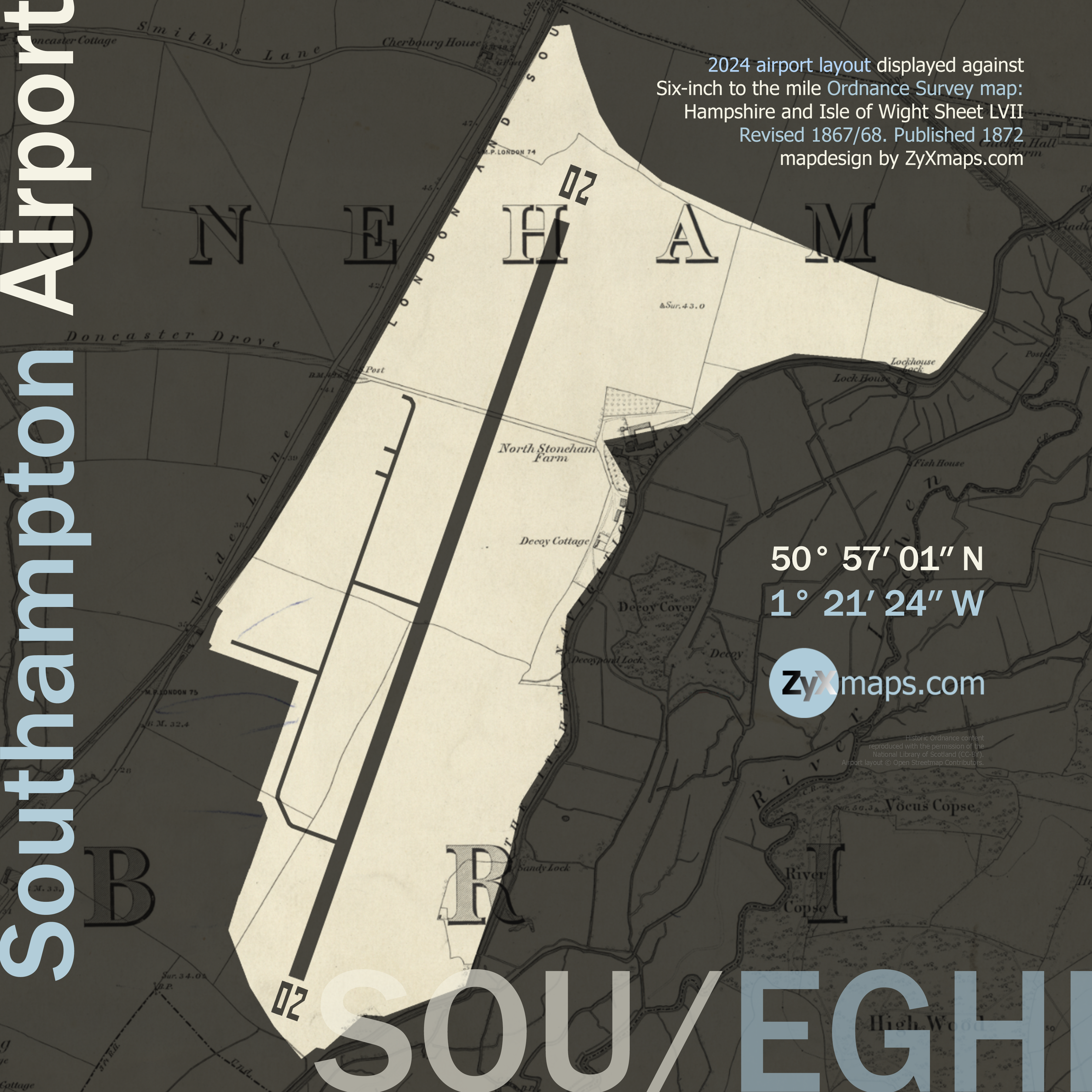
Southampton Airport, originally established as a grass airfield in 1910, has seen its fair share of historical events and significant milestones. During World War I, the airfield was repurposed as a base for the Royal Flying Corps, leading to extensive development and the construction of hangars. In the 1930s, it became the primary base for the innovative Supermarine aircraft, including the legendary Spitfire, which made its maiden flight from Southampton in 1936. This period cemented the airport’s role in the aviation industry and marked it as a site of technological advancements.
The airport’s prominence continued into World War II, serving as a crucial operational base for various RAF squadrons. Post-war, Southampton Airport transitioned to civil aviation, facilitating commercial flights and rapidly growing in passenger numbers. The 1950s saw the introduction of scheduled flights to destinations such as the Channel Islands and mainland Europe, positioning the airport as a vital regional hub. Significant infrastructure improvements followed, including the construction of modern terminals and extended runways to accommodate larger aircraft. The early 2000s witnessed a surge in low-cost carriers, boosting the airport’s popularity among budget travelers.
Read about aviation pioneer Edwin Moon’s first flight from Southampton in 1910.
Fly to another aiport map: London City airport
© 2025 ZyXmaps.com
Historic Ordnance Survey mapping used for ZyXmaps’s ‘UK airport landscapes’ series is reproduced with the permission of the National Library of Scotland (CC-BY). Airport layout © Open Streetmap Contributors. Photographs © edition ND.